ISS pass tonight? Ask the sky over your own street
Most sky apps assume you know the constellations. The Tonight view in Space Radar assumes you know which way is south. What it works out for one street on one evening, and what it admits it cannot know.
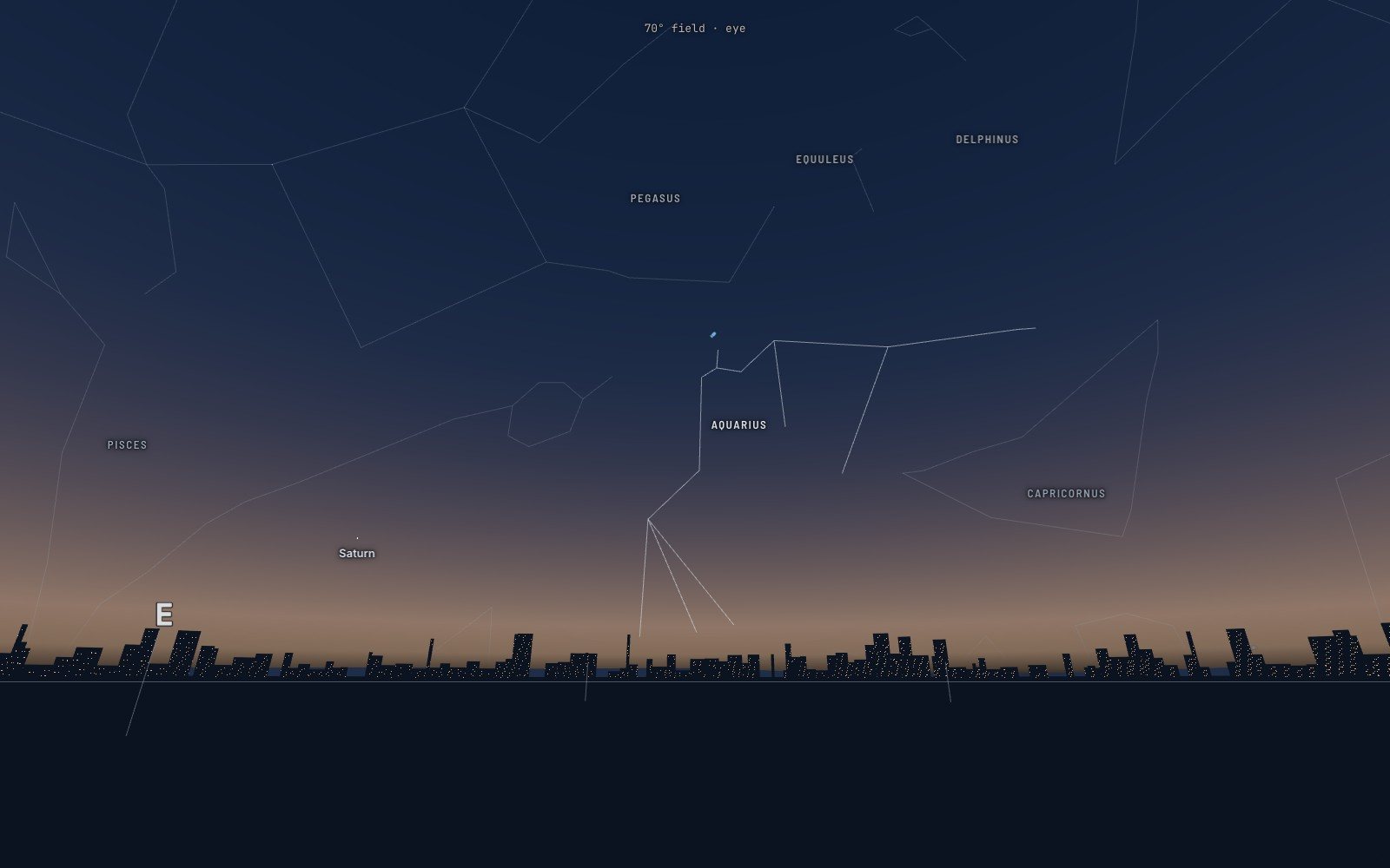
Saturn rising over London at 19:30, a few days after its closest and brightest of the year. The skyline is a drawing of a city, and the panel says so: “Not your street.”
Friday 9 October 2026, half past seven in the evening, London. The Sun went down about an hour ago and the sky in the west is still the colour of weak tea. Say someone has stepped out onto the pavement with a phone, because a child asked whether you can see the space station from here.
The question they type is the obvious one: is there an ISS pass tonight? I had asked exactly that, for London, two nights earlier, and the answer was not the one I hoped for. The station’s next pass was on Thursday morning at 09:19, two fists above the southern horizon, for about five minutes. Under the time there was one more sentence: “You would not see this pass: your sky is too light, or the station is in the Earth’s shadow.”
That is a disappointing thing for a space map to say, and I think it is the most useful sentence on the page. This piece is about the part of Space Radar called Tonight: what it works out for one street on one evening, how it decides what is worth your ten minutes outside, and what it admits it cannot know.
A list of seven, not a timetable#
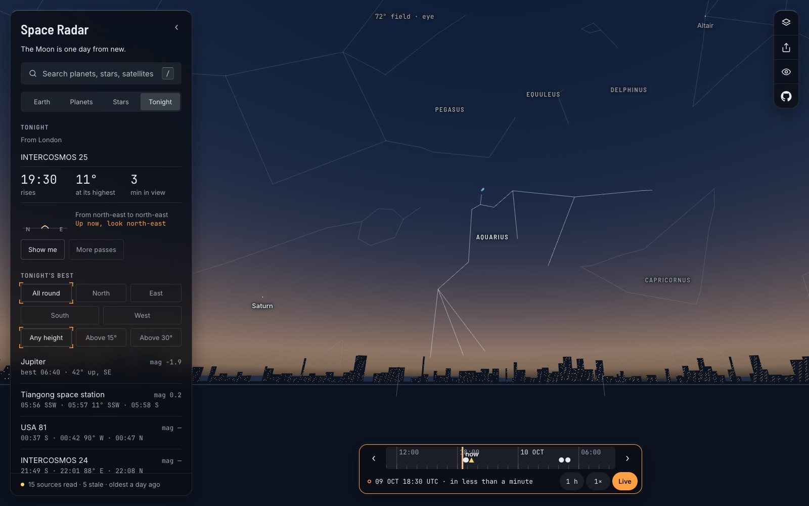
Look at what the panel offers instead. Saturn, at magnitude 0.2, best at half past midnight, forty degrees up in the south. Jupiter before dawn, brighter still. The Pleiades by eye at 03:30. The Andromeda Galaxy, with the word “binoculars” beside it. China’s station, Tiangong, at 05:57, but only eleven degrees up.
That is the whole list, and its shortness is a rule. The code that ranks it says so in a comment I like: a row’s score is how easy the thing is to see, “a rule, not a taste”. Brightness counts most, then height. At most seven rows, and never more than three satellite passes, because “this is a list of what to look at, not a timetable”.
Two of the satellites in the list have a dash where their brightness should be. The map holds a published standard brightness for exactly two objects, the two space stations. For everything else it does not know, and so it prints “—”. A dash is less impressive than a number, and it is true.
Heights are given in degrees and, in the trips, in fists. A fist held at arm’s length covers about ten degrees of sky, which is the only instrument most of us carry.
What “visible” means#
Back to the pass at 09:19. The station was there. It crossed the sky above London exactly as computed, 429 kilometres up. Nobody could have seen it, for the same reason nobody sees the stars at breakfast.
A satellite has no light of its own that you could see from the ground. You see sunlight bouncing off it. So three things have to be true at once, and the map checks all three: the satellite is high enough, more than ten degrees above your horizon; it is in sunlight; and you are in the dark, with the Sun at least six degrees below your own horizon. NASA’s own guidance says the same thing in plainer words: all sightings fall within a few hours before or after sunrise or sunset.
In the middle of the night it fails the other way. You are in the dark, and so is the station, which has followed you into the Earth’s shadow. The small arc the map draws for each pass shows this: a solid line while the object is sunlit, a dashed one once it has gone into shadow. Many evening passes simply stop half way up the sky.
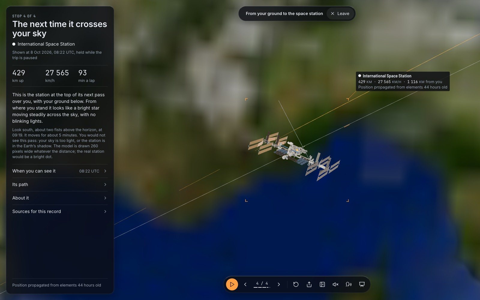
You can ask this of any satellite. Open the space station’s card and “When you can see it” gives the next pass for your place, or the last stop of the trip up to the station flies you to it. The same goes for Tiangong, the other place where people live up there.
You would not see this pass: your sky is too light, or the station is in the Earth’s shadow.
It does not assume you know the constellations#
Most astronomy apps are built around a star chart, and a star chart is a wonderful thing if you can already read one. Tonight starts from the other end. It gives a name you know, a clock time, a height and a compass direction: “best 00:30 · 40° up, S”. If you can find south, you can find Saturn.
There are buttons for the sky you really have. North, East, South, West, for a window that faces one way. “Above 15°” and “Above 30°”, for a street with buildings on it. Dusk, Midnight and Dawn, to move the whole sky to the hour you will be awake.
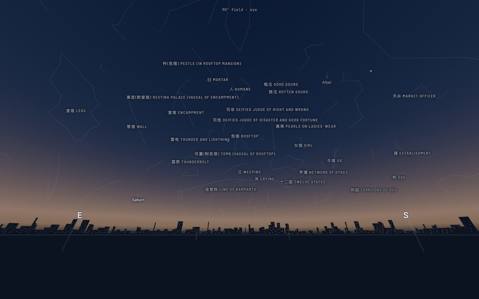
When you do want the figures, they are there, and not only ours. The lines can be switched to pictures, drawn by the artist Johan Meuris for Stellarium and shared under a free licence. And the 88 constellations that astronomers agreed on in 1922 can be exchanged for the Chinese sky, the Māori or the Hawaiian. Over London that Friday the patch of sky we call Aquarius holds, in the Chinese reading, the Rooftop, the Tomb, the Weeping and the Crying, and a pair of Deified Judges.
Your street, honestly#
The harder question is whose sky this is. The answer is: roughly yours, and the page tells you how roughly.
It needs a place. With none set, it guesses from your device’s time zone and says that it is a guess. It does not look up your address from the network. You can pick a city from a list or let the browser share your position, behind a tap. The place stays in your browser.
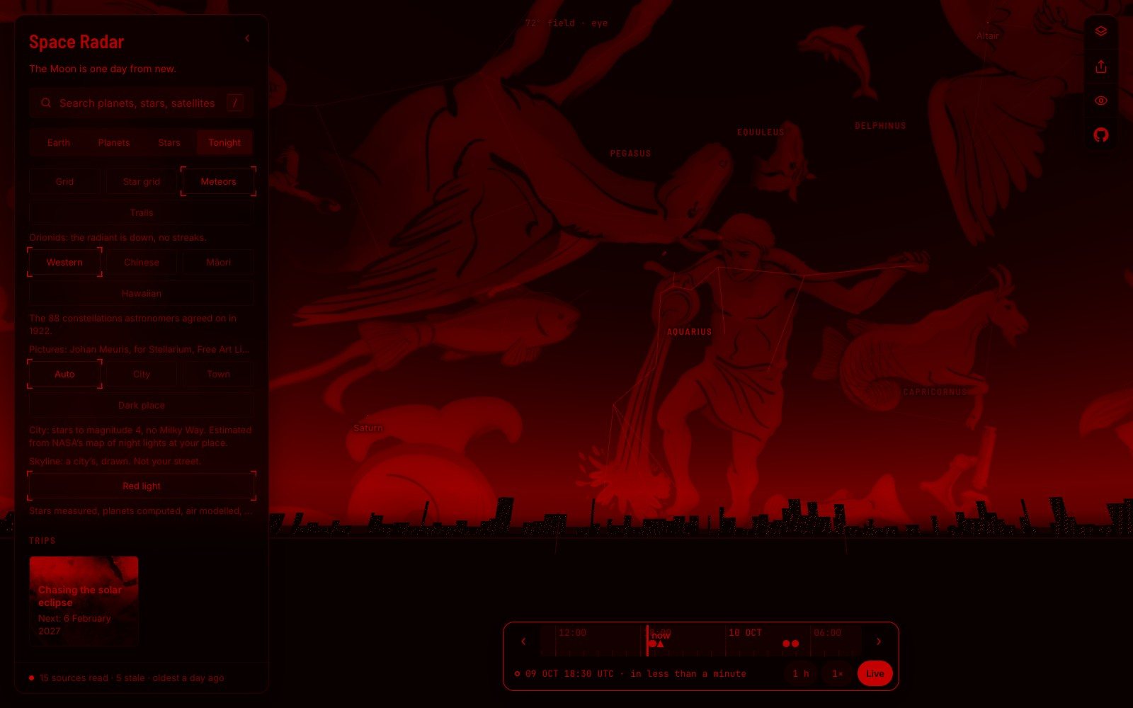
It needs to know how dark your sky is, and it does not ask. It reads NASA’s map of the Earth’s lights at night for your spot and decides: city, town or dark place. For central London the line is blunt: “City: stars to magnitude 4, no Milky Way.” You can overrule it, and see what the same evening would look like from a field.
And it needs a horizon, which it cannot have. So it draws one, hills or roofs, and labels it. Under all the switches is a single sentence that sorts the whole picture into what kind of truth each part is:
- 4 wordsfor the four kinds of truth in the sky view: “Stars measured, planets computed, air modelled, land drawn.”
There is also a red switch. Red is the traditional colour of an observer’s torch, the one that is kindest to eyes that have got used to the dark, and one tap turns the whole page that colour.
On the pavement#
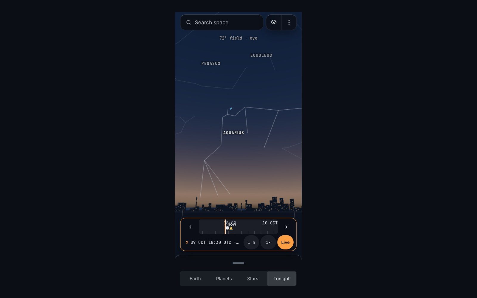
Everything above is on the phone as well, which is where it belongs. The sheet at the bottom slides out of the way and the sky fills the screen; the time bar stays, so a thumb can pull the evening forward to the hour the station comes.
It has limits that no panel can fix. It does not know about your clouds; one of its own sentences ends “weather allowing”. A pass is only as good as the orbital data it was worked out from, which the card dates. The brightness of anything but the two stations is an estimate or a dash. All of it is in English.
But the list is short, and it is for your street. There is a seven-stop trip that walks through it in order, tonight from your street: a first star, one figure, the Moon if it is up, a planet, the station’s next pass. Or open the Tonight view itself and tell it your town.
Then put the phone in your pocket. On an October evening in 2026, face south-east, and look for the one steady light that does not twinkle. That is Saturn, about 1.3 billion kilometres away, and it needs no pass at all.
Questions people ask
Is there an ISS pass tonight where I live?
It depends on your place and the date; there are stretches of days with no visible pass at all. A tracker that knows your location lists the next ones, and should say whether each can actually be seen.
Why can I only see the space station around dusk or dawn?
Because you are seeing sunlight on it. The station must be in sunshine while you are in darkness, which happens in the hours after sunset and before sunrise.
How do I find a planet without knowing the constellations?
Use a time, a compass direction and a height. A planet is a bright point that does not twinkle; a fist at arm’s length is about ten degrees.
Does Space Radar need my location?
No. It guesses a place from your time zone and says so; you can choose a city by hand. Nothing about your place is sent to a server.
Sources
- GitHub github.com
- About ten degrees earthsky.org
- Within a few hours before or after sunrise or sunset nasa.gov
- Astronomers agreed on in 1922 iau.org
- Spaceradar.ai spaceradar.ai
- Astronomy.com: sky this month october 2026 astronomy.com
- Heavens-above.com: faq.aspx heavens-above.com
Explore on Space Radar
Keep reading
What Is in the Sky Tonight? Relearning to Look Up
What is in the sky tonight, seen from an ordinary city balcony, is a short list. Almost nobody is taught it any more. It takes one evening to learn.
Solar Eclipse 2027: Six Minutes of Night at Noon
The solar eclipse of 2027 will put Luxor in the dark for more than six minutes, the longest totality anyone will stand under until 2114. Here is the day, minute by minute, and where the shadow does and does not reach.
Where is the ISS right now? Two addresses in the sky
Ten people live off the planet this week, in exactly two homes. What their days are like, why the stations fly where they do, how to watch one cross your own street, and what happens when the bigger one comes down.